Picture 1 of 4


Gallery
Picture 1 of 4


Have one to sell?
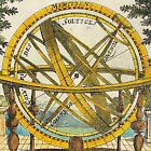
River Thames map by Taunt Oxfordshire Kelmscott Eaton Hastings and Radcot 1885

GBP 81.00
ApproximatelyC $148.67
Condition:
“Good Condition - Please see description below”
- Buy It NowRiver Thames map by Taunt Oxfordshire Kelmscott Eaton Hastings and Radcot 1885
Oops! Looks like we're having trouble connecting to our server.
Refresh your browser window to try again.
Shipping:
GBP 8.90 (approx C $16.33) Standard Int'l Postage.
International shipment of items may be subject to customs processing and additional charges.
Located in: Bourne End, United Kingdom
Delivery:
Estimated between Tue, Aug 12 and Thu, Aug 21 to 94104
Returns:
No returns accepted.
Payments:
Shop with confidence
Seller assumes all responsibility for this listing.
eBay item number:156904092852
Item specifics
- Seller Notes
- “Good Condition - Please see description below”
- Date Range
- 1800-1899
- Type
- River Map
- Printing Technique
- Lithography
- Format
- Sheet Map
- Year
- 1885
- Era
- 1800s
- Cartographer/Publisher
- Henry Taunt
- Original/Reproduction
- Antique Original
- City
- Kelmscott
- Country/Region
- England / Surrey
- County
- Oxfordshire
- Antique/ Modern
- Antique
Item description from the seller
Popular categories from this store
Seller feedback (1,848)
- r***r (63)- Feedback left by buyer.Past monthVerified purchaseThank you so much for the print of the Crocus fairy by Cicely Mary Barker. The postage is good. The packaging is good. The item is as described and good value for money.
- i***a (46)- Feedback left by buyer.Past 6 monthsVerified purchaseSwift delivery, well packed, good value and just as described
- u***y (627)- Feedback left by buyer.Past 6 monthsVerified purchaseSuper, just as described and packaged securely. Arrived quickly too!
More to explore:
- Antique European Maps & Atlases Oxfordshire,
- Antique European Maps & Atlases England Oxfordshire,
- Antique European Maps & Atlases Oxford Oxfordshire,
- Oxfordshire Antique Original Antique European Maps & Atlases,
- Oxfordshire Copper Plate Antique Europe Maps & Atlases,
- River Map Antique Sheet Maps,
- Antique European Maps & Atlases Oxfordshire 1700-1799 Date Range,
- Antique Original River Map Antique Sheet Maps,
- Antique Original River Map Antique Atlas Maps,
- London Antique Europe River Maps
Popular categories from this store
Seller feedback (1,848)
- r***r (63)- Feedback left by buyer.Past monthVerified purchaseThank you so much for the print of the Crocus fairy by Cicely Mary Barker. The postage is good. The packaging is good. The item is as described and good value for money.
- i***a (46)- Feedback left by buyer.Past 6 monthsVerified purchaseSwift delivery, well packed, good value and just as described
- u***y (627)- Feedback left by buyer.Past 6 monthsVerified purchaseSuper, just as described and packaged securely. Arrived quickly too!