
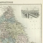
England & Wales map 1884 for J Migeon Atlas coloured vignette London
GBP 34.95GBP 34.95
Mon, May 26, 06:49 AMMon, May 26, 06:49 AM
Picture 1 of 4


Gallery
Picture 1 of 4

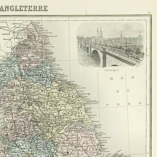


England & Wales map 1884 for J Migeon Atlas coloured vignette London
GBP 34.95
ApproximatelyC $65.62
Condition:
“Good Condition - Please see description below”
Oops! Looks like we're having trouble connecting to our server.
Refresh your browser window to try again.
Shipping:
GBP 7.90 (approx C $14.83) Standard Int'l Postage.
International shipment of items may be subject to customs processing and additional charges.
Located in: Bourne End, United Kingdom
Delivery:
Estimated between Thu, Jul 3 and Tue, Jul 15 to 94104
Returns:
30 days return. Buyer pays for return shipping. If you use an eBay shipping label, it will be deducted from your refund amount.
Payments:
Shop with confidence
Seller assumes all responsibility for this listing.
eBay item number:156930652435
Item specifics
- Seller Notes
- “Good Condition - Please see description below”
- Format
- Sheet Map
- Era
- 1800s
- Region
- British Isles
- Printing Technique
- Steel engraved
- Year
- 1884
- Map Type
- Historical/ Political
- County
- All England
- Antique/ Modern
- Antique
- City
- London
- Country/Region
- England & Wales
- Cartographer/Publisher
- J. Migeon
- Date Range
- 1800-1899
- Type
- Atlas Map
- Original/Reproduction
- Antique Original
Item description from the seller
Seller Feedback
No feedback yet
More to explore:
- Wales London Antique Europe Atlas Maps,
- London England Antique Europe Atlas Maps,
- England London Antique Europe Atlas Maps,
- Wales Antique Europe Atlas Maps,
- London Wales London Antique Europe Maps & Atlases,
- Wales Lithography Antique Europe Atlas Maps,
- Antique European Maps & Atlases London Wales,
- London Wales Antique Europe Railroad Maps,
- England City Map Antique Europe Atlas Maps,
- London England Antique Europe Folding Maps