Picture 1 of 4


Gallery
Picture 1 of 4


Have one to sell?
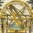
British Isles map by Mallet Saxon Heptarchy 1683 Original copperplate

GBP 72.00
ApproximatelyC $132.59
Condition:
“Excellent overall condition - please see description below”
- Buy It NowBritish Isles map by Mallet Saxon Heptarchy 1683 Original copperplate
Oops! Looks like we're having trouble connecting to our server.
Refresh your browser window to try again.
Shipping:
GBP 8.90 (approx C $16.39) Royal Mail International Tracked.
International shipment of items may be subject to customs processing and additional charges.
Located in: Bourne End, United Kingdom
Delivery:
Estimated between Fri, Jul 25 and Fri, Aug 1 to 94104
Returns:
No returns accepted.
Payments:
Shop with confidence
Seller assumes all responsibility for this listing.
eBay item number:157021465200
Item specifics
- Seller Notes
- “Excellent overall condition - please see description below”
- County
- Asia, Africa, Europe
- Region
- Eastern Hemisphere
- Cartographer/Publisher
- Allain Manesson Mallet / Johann David Zunner
- Printing Technique
- Copper Plate
- City
- London
- Date Range
- 1600-1699
- Original/Reproduction
- Antique Original
- Era
- 1600s
- Format
- Atlas Universal Dictionary Map
- COLOURING:
- Outline and wash Colour
- ORIGINAL / REPRO:
- Original
- Type
- Ancient Climate Map
- MAKER:
- Allain Manesson Mallet
- AGE:
- c1683
- SELLER NOTES:
- Excellent overall condition - See Description
- Year
- 1684
- Map Type
- English County Map
- Antique/ Modern
- Antique
Item description from the seller
Popular categories from this store
Seller feedback (1,845)
- i***a (45)- Feedback left by buyer.Past 6 monthsVerified purchaseSwift delivery, well packed, good value and just as described
- u***y (616)- Feedback left by buyer.Past 6 monthsVerified purchaseSuper, just as described and packaged securely. Arrived quickly too!
- a***l (222)- Feedback left by buyer.Past 6 monthsVerified purchaseTutto positivo! Spedizione ben imballata e arrivata sana e salva senza rovinarsi. Ottimo venditore.Schloss Tyrol near Merano Italy Tyrol Castle woodcut print 1875 (#167399552811)
More to explore:
- Isle of Wight Antique Original Antique Europe Maps & Atlases,
- Antique European Maps & Atlases Isle of Wight,
- British Columbia Antique Original Antique North America Atlas Maps,
- British Columbia Antique Original Antique North America Maps & Atlases,
- England Isle of Wight Antique Europe Maps & Atlases,
- Antique Original City Map Antique Atlas Maps,
- Antique Original Railroad Map Antique Atlas Maps,
- Vintage Original County Map Antique Folding Maps,
- Antique Original Nautical Map Antique Folding Maps,
- Antique Original River Map Antique Folding Maps
Popular categories from this store
Seller feedback (1,845)
- i***a (45)- Feedback left by buyer.Past 6 monthsVerified purchaseSwift delivery, well packed, good value and just as described
- u***y (616)- Feedback left by buyer.Past 6 monthsVerified purchaseSuper, just as described and packaged securely. Arrived quickly too!
- a***l (222)- Feedback left by buyer.Past 6 monthsVerified purchaseTutto positivo! Spedizione ben imballata e arrivata sana e salva senza rovinarsi. Ottimo venditore.Schloss Tyrol near Merano Italy Tyrol Castle woodcut print 1875 (#167399552811)