Picture 1 of 15


Gallery
Picture 1 of 15


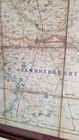
⚡An antique map of Huntingdonshir

GBP 39.99
ApproximatelyC $75.08
or Best Offer
Was GBP 49.99 (20% off)
Condition:
Sale ends in: 6d 16h
- Buy It Now⚡An antique map of Huntingdonshire by J. & C. Walker. Published by Longman 1836⚡
Oops! Looks like we're having trouble connecting to our server.
Refresh your browser window to try again.
Shipping:
GBP 31.29 (approx C $58.75) International Priority Shipping to United States via eBay's Global Shipping Program.
Located in: Redruth, United Kingdom
Import charges:
Free amount confirmed at checkout
Delivery:
Estimated between Thu, Jul 10 and Mon, Jul 21 to 94104
Includes international tracking
Returns:
30 days return. Buyer pays for return shipping. If you use an eBay shipping label, it will be deducted from your refund amount.
Payments:
Shop with confidence
Seller assumes all responsibility for this listing.
eBay item number:195701477624
Item specifics
- Antique
- Yes
- Date Range
- 1800-1899
- Type
- City Map
- Printing Technique
- Woodcut
- Format
- Folding Map
- Year
- 1836
- Era
- 1800s
- Cartographer/Publisher
- Longman, Rees, Orme, Brown & Co., London
- Original/Reproduction
- Antique Original
- City
- Cambridge
- Country/Region
- United Kingdom
- County
- Huntingdonshire
Item description from the seller

Seller feedback (1,150)
- 9***7 (1066)- Feedback left by buyer.Past monthVerified purchaseSpeedy Postage&packaging item as described great value !.. great seller 5⭐️⭐️⭐️⭐️⭐️
- 5***n (141)- Feedback left by buyer.Past 6 monthsVerified purchaseExcellence service. Very well wrapped ,took a long time to unwrap but worth the effort. Beautiful items just as descript. Quick response after asking a question. Thank youBeautiful Vintage nest of tables mahogany cabriole legs glass tops (#197048006123)
- a***a- Feedback left by buyer.Past 6 monthsVerified purchaseGood seller, well packaged , shipped quick, as described,
More to explore:
- Antique European Maps & Atlases Huntingdonshire,
- Antique European Maps & Atlases England Huntingdonshire,
- Antique European Maps & Atlases Huntingdonshire 1800-1899 Date Range,
- C. Augustus Antique Maps, Atlases & Globes,
- Antique Atlas Maps,
- Antique Original Topographical Map Antique Wall Maps,
- Antique Original County Map Antique Sheet Maps,
- Antique Original Physical Map Antique Sheet Maps,
- Antique Original Railroad Map Antique Sheet Maps,
- Antique Original Railroad Map Antique Wall Maps
Seller feedback (1,150)
- 9***7 (1066)- Feedback left by buyer.Past monthVerified purchaseSpeedy Postage&packaging item as described great value !.. great seller 5⭐️⭐️⭐️⭐️⭐️
- 5***n (141)- Feedback left by buyer.Past 6 monthsVerified purchaseExcellence service. Very well wrapped ,took a long time to unwrap but worth the effort. Beautiful items just as descript. Quick response after asking a question. Thank youBeautiful Vintage nest of tables mahogany cabriole legs glass tops (#197048006123)
- a***a- Feedback left by buyer.Past 6 monthsVerified purchaseGood seller, well packaged , shipped quick, as described,