Picture 1 of 4


Gallery
Picture 1 of 4


Have one to sell?
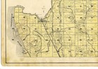
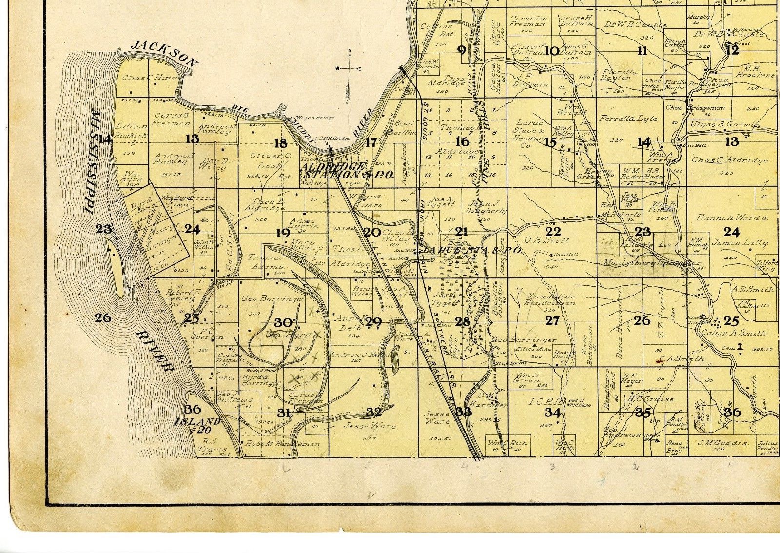
1908 Map of Preston, Illinois, from Atlas of Union County w/family names - rare

US $45.00
ApproximatelyC $61.86
Condition:
- Buy It Now1908 Map of Preston, Illinois, from Atlas of Union County w/family names - rare
Oops! Looks like we're having trouble connecting to our server.
Refresh your browser window to try again.
Shipping:
US $11.95 (approx C $16.43) USPS Priority Mail®.
Located in: Athol, Massachusetts, United States
Delivery:
Estimated between Fri, Aug 15 and Thu, Aug 21 to 94104
Returns:
14 days return. Buyer pays for return shipping. If you use an eBay shipping label, it will be deducted from your refund amount.
Payments:
Shop with confidence
Seller assumes all responsibility for this listing.
eBay item number:202308079493
Item specifics
- Type
- County Map
- Year
- 1908
- US State
- Illinois
Item description from the seller

Popular categories from this store
Seller feedback (438)
- l***2 (320)- Feedback left by buyer.More than a year agoVerified purchaseSuper fast shipping! Great item and great seller. Packaging was fantastic, thank you for shipping flat with protective covering rather than rolled in a tube.1875 Delaware, NY map, from Beers' Atlas of Sullivan County, New York - original (#191895000668)
- h***r (2179)- Feedback left by buyer.More than a year agoVerified purchasevery nice seller, excellent packing job and fast shipping, highly recommend!!1876 Beers Map of Williamstown and Williamstown villages (#204181034150)
- -***a (183)- Feedback left by buyer.More than a year agoVerified purchaseGreat seller. Accommodating. Clear communicator. Item shipped quick & safely.1877 old map of Thetford, Vermont from Atlas of Orange County, with family names (#193081665605)
More to explore:
- Illinois County Map Antique North America Atlas Maps,
- Illinois County Map Antique North America Atlas,
- County Map Antique Atlas Maps,
- County Map Antique Atlas,
- Contemporary County Map Antique Atlas Maps,
- County Map Antique Africa Atlas Maps,
- County Map Antique North America Atlas Maps,
- France County Map Antique Europe Atlas Maps,
- Copper Plate County Map Antique Atlas Maps,
- Delaware County Map Antique North America Atlas Maps
Popular categories from this store
Seller feedback (438)
- l***2 (320)- Feedback left by buyer.More than a year agoVerified purchaseSuper fast shipping! Great item and great seller. Packaging was fantastic, thank you for shipping flat with protective covering rather than rolled in a tube.1875 Delaware, NY map, from Beers' Atlas of Sullivan County, New York - original (#191895000668)
- h***r (2179)- Feedback left by buyer.More than a year agoVerified purchasevery nice seller, excellent packing job and fast shipping, highly recommend!!1876 Beers Map of Williamstown and Williamstown villages (#204181034150)
- -***a (183)- Feedback left by buyer.More than a year agoVerified purchaseGreat seller. Accommodating. Clear communicator. Item shipped quick & safely.1877 old map of Thetford, Vermont from Atlas of Orange County, with family names (#193081665605)