Picture 1 of 12


Gallery
Picture 1 of 12


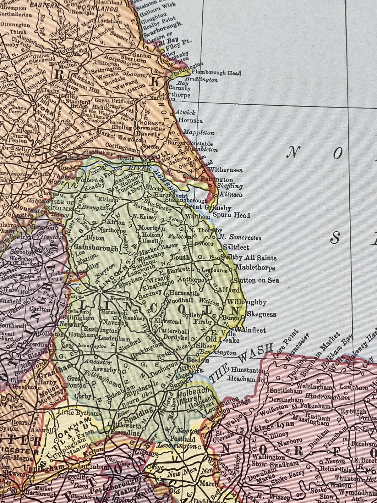


1900 Colored Map ENGLAND & WALES, Cities, Towns, Historical, 2 Pages, 22" x 14"
US $18.00
ApproximatelyC $24.84
Condition:
“Clean, no damage to map pages, 2 pages can be trimmed and lined up very well, one rough edge from ”... Read moreabout condition
- Buy It Now1900 Colored Map ENGLAND & WALES, Cities, Towns, Historical, 2 Pages, 22" x 14"
Oops! Looks like we're having trouble connecting to our server.
Refresh your browser window to try again.
Shipping:
US $4.15 (approx C $5.73) USPS Ground Advantage®.
Located in: Saco, Maine, United States
Delivery:
Estimated between Mon, May 5 and Sat, May 10 to 43230
Returns:
No returns accepted.
Payments:
Shop with confidence
Seller assumes all responsibility for this listing.
eBay item number:204059724495
Item specifics
- Seller Notes
- Cartographer/Publisher
- Rand McNally & Co.
- Original/Reproduction
- Antique Original
- Format
- Atlas Map
- Date Range
- 1900-1909
- Country/Region
- England, Wales
Item description from the seller

Seller feedback (5,582)
- n***p (892)- Feedback left by buyer.Past monthVerified purchaseGreat seller! Great packing. Excellent communication. Better than the description. I feel like I got a great bargain . Shipping and packing was amazing.
- n***u (280)- Feedback left by buyer.Past 6 monthsVerified purchaseItem as described, packed well, no issues. Fair price, good value. Shipping costs were very reasonable. Overall great transaction and wonderful seller! Thanks very much!
- l***t (192)- Feedback left by buyer.Past monthVerified purchaseExtremely well packaged, shipped rapidly and exactly as described for a great price. Highly recommended seller! A+++
More to explore:
- England Antique Europe City Maps,
- England City Map Antique Europe Atlas Maps,
- London England Antique Europe City Maps,
- England London Antique Europe City Maps,
- Antique European Maps & Atlases Wales 1900-1909 Date Range,
- Wales Antique Europe Maps & Atlases,
- Wales Antique Europe Railroad Maps,
- 1900-1909 Date Range Antique City Maps,
- London Antique European Maps & Atlases England 1900-1909 Date Range,
- England London Antique European Maps & Atlases 1900-1909 Date Range
Seller feedback (5,582)
- n***p (892)- Feedback left by buyer.Past monthVerified purchaseGreat seller! Great packing. Excellent communication. Better than the description. I feel like I got a great bargain . Shipping and packing was amazing.
- n***u (280)- Feedback left by buyer.Past 6 monthsVerified purchaseItem as described, packed well, no issues. Fair price, good value. Shipping costs were very reasonable. Overall great transaction and wonderful seller! Thanks very much!
- l***t (192)- Feedback left by buyer.Past monthVerified purchaseExtremely well packaged, shipped rapidly and exactly as described for a great price. Highly recommended seller! A+++