Picture 1 of 6


Gallery
Picture 1 of 6


Have one to sell?
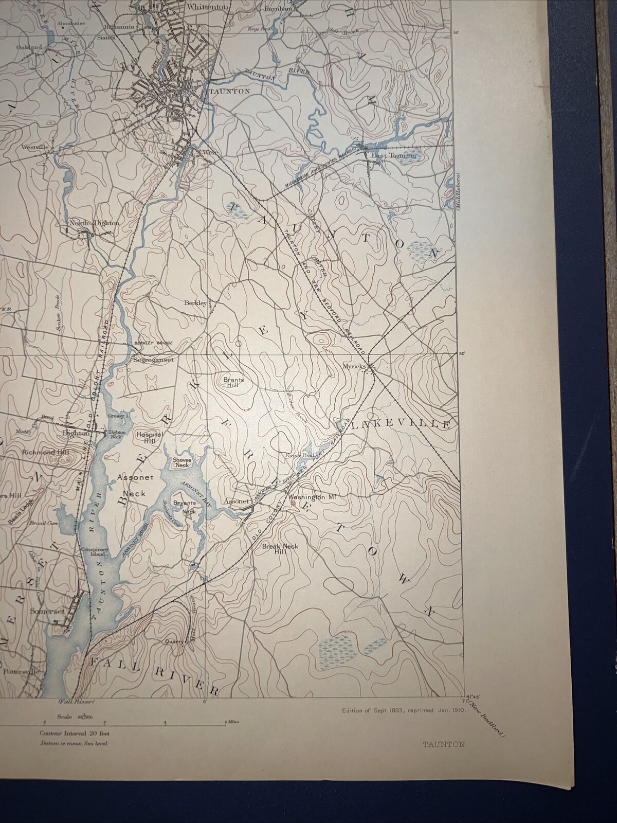
1910 USGS topo map Taunton Quadrangle Massachusetts Fall River Rehoboth Assonet

US $99.00
ApproximatelyC $135.89
or Best Offer
Condition:
“This map is near perfect, without any major stains, folds, tears or marks. See the attached photos.”
- Buy It Now1910 USGS topo map Taunton Quadrangle Massachusetts Fall River Rehoboth Assonet
Oops! Looks like we're having trouble connecting to our server.
Refresh your browser window to try again.
Shipping:
US $4.50 (approx C $6.18) USPS First Class®.
Located in: Slingerlands, New York, United States
Delivery:
Estimated between Thu, Jul 31 and Thu, Aug 7
Returns:
30 days return. Buyer pays for return shipping. If you use an eBay shipping label, it will be deducted from your refund amount.
Payments:
Shop with confidence
Seller assumes all responsibility for this listing.
eBay item number:204090404826
Item specifics
- Seller Notes
- “This map is near perfect, without any major stains, folds, tears or marks. See the attached photos.”
- Original/Reproduction
- Antique Original
- Type
- Topographical Map
- Year
- 1912
- US State
- CT, MA, ME, NH, RI, VT
- Date Range
- 1900-1909
- City
- Boston
Item description from the seller

Popular categories from this store
Seller feedback (892)
- 6***2 (25)- Feedback left by buyer.Past 6 monthsVerified purchaseMap was incredible shape, exceeded my expectations, fast shipping, great communication, adjusted shipping cost when I found this map after ordering the first map very respectful in saving me shipping cost, Highly recommend this seller and I will definitely buy from Barrington maps again
- 8***m (328)- Feedback left by buyer.Past 6 monthsVerified purchaseGreat transaction!!! Item was well packaged, protected and shipped promptly. The item was exactly as described. The seller is highly recommend.1940's Army topographic map Pendleton Virginia -Sheet 5459 IV SE (#202647278229)
- 5***s (8)- Feedback left by buyer.Past 6 monthsVerified purchaseThis seller is great! I had a little issue and he cleared it up immediately. Got exactly what was pictured. At a good price.1940's Army topographic map Earleville Maryland -Sheet 5862 IV NW (#202647276108)
More to explore:
- Massachusetts Antique North America River Maps,
- Massachusetts Antique Original Antique North America River Maps,
- 1910-1919 Date Range Antique River Maps,
- Massachusetts Antique North America Maps & Atlases 1910-1919 Date Range,
- 1910-1919 Date Range Folding Map River Map Antique Maps, Atlases & Globes,
- 1910-1919 Date Range River Map Antique North America Folding Maps,
- 1910-1919 Date Range Antique North America River Maps,
- Lithography 1910-1919 Date Range Antique North America River Maps,
- Massachusetts Antique North America Sheet Maps,
- Massachusetts Antique North America Nautical Maps
Popular categories from this store
Seller feedback (892)
- 6***2 (25)- Feedback left by buyer.Past 6 monthsVerified purchaseMap was incredible shape, exceeded my expectations, fast shipping, great communication, adjusted shipping cost when I found this map after ordering the first map very respectful in saving me shipping cost, Highly recommend this seller and I will definitely buy from Barrington maps again
- 8***m (328)- Feedback left by buyer.Past 6 monthsVerified purchaseGreat transaction!!! Item was well packaged, protected and shipped promptly. The item was exactly as described. The seller is highly recommend.1940's Army topographic map Pendleton Virginia -Sheet 5459 IV SE (#202647278229)
- 5***s (8)- Feedback left by buyer.Past 6 monthsVerified purchaseThis seller is great! I had a little issue and he cleared it up immediately. Got exactly what was pictured. At a good price.1940's Army topographic map Earleville Maryland -Sheet 5862 IV NW (#202647276108)