
Picture 1 of 12


ENDED
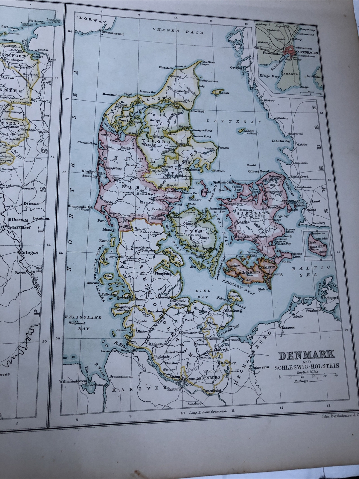
1891: Map of France Holland & Belgium Denmark & Schleswig Holstein CTA Antique
Condition:
Price:
GBP 24.95
ApproximatelyC $43.45
Shipping:
International shipment of items may be subject to customs processing and additional charges.
Located in: Evington, Leicestershire, United Kingdom
Delivery:
Estimated between Fri, May 31 and Fri, Jun 7 to 43230
Please allow additional time if international delivery is subject to customs processing.
Returns:
Payments:
Shop with confidence
Seller assumes all responsibility for this listing.
eBay item number:276206134923
Item specifics
- Date Range
- 1800-1899
- Antique
- Yes
- Type
- Political Map
- Format
- Sheet Map
- Printing Technique
- Lithography
- Year
- 1891
- Era
- 1800s
- State
- Schleswig-Holstein
- Cartographer/Publisher
- John Bartholomew
- Original/Reproduction
- Antique Original
- Country/Region
- Denmark, Holland, Belgium, France
Item description from the seller
Seller assumes all responsibility for this listing.
eBay item number:276206134923
Shipping and handling
Item location:
Evington, Leicestershire, United Kingdom
Ships to:
Worldwide
Excludes:
Afghanistan, Libya, Nauru, Russian Federation, Somalia, Ukraine, Yemen
| Shipping and handling | To | Service | Delivery*See Delivery notes |
|---|---|---|---|
| GBP 9.00 (approx C $15.67) | United States | Standard Shipping (Royal Mail International Standard) |
| Handling time |
|---|
| Will usually ship within 2 business days of receiving cleared payment. |
| Taxes |
|---|
| Taxes may be applicable at checkout. Learn moreLearn more about paying tax on eBay purchases |
Sales tax for an item #276206134923
Sales tax for an item #276206134923
Seller collects sales tax for items shipped to the following provinces:
| Province | Sales Tax Rate |
|---|
Return policy
| Return policy details |
|---|
| The seller will not accept returns for this item. |
Payment details
Payment methods

More to explore:
- Denmark Schleswig-Holstein Antique Europe Maps & Atlases,
- Denmark Schleswig-Holstein 1800-1899 Date Range Antique Europe Maps & Atlases,
- Antique European Maps & Atlases Schleswig-Holstein,
- Schleswig-Holstein Antique Original Antique Europe Maps & Atlases,
- Schleswig-Holstein 1600-1699 Date Range Antique Europe Maps & Atlases,
- Schleswig-Holstein 1800-1899 Date Range Antique Europe Maps & Atlases,
- Belgium Antique Europe Folding Maps,
- Denmark Antique Europe County Maps,
- Paris France Antique Maps,
- Belgium Antwerp Antique Europe City Maps