Picture 1 of 7


Gallery
Picture 1 of 7


Have one to sell?
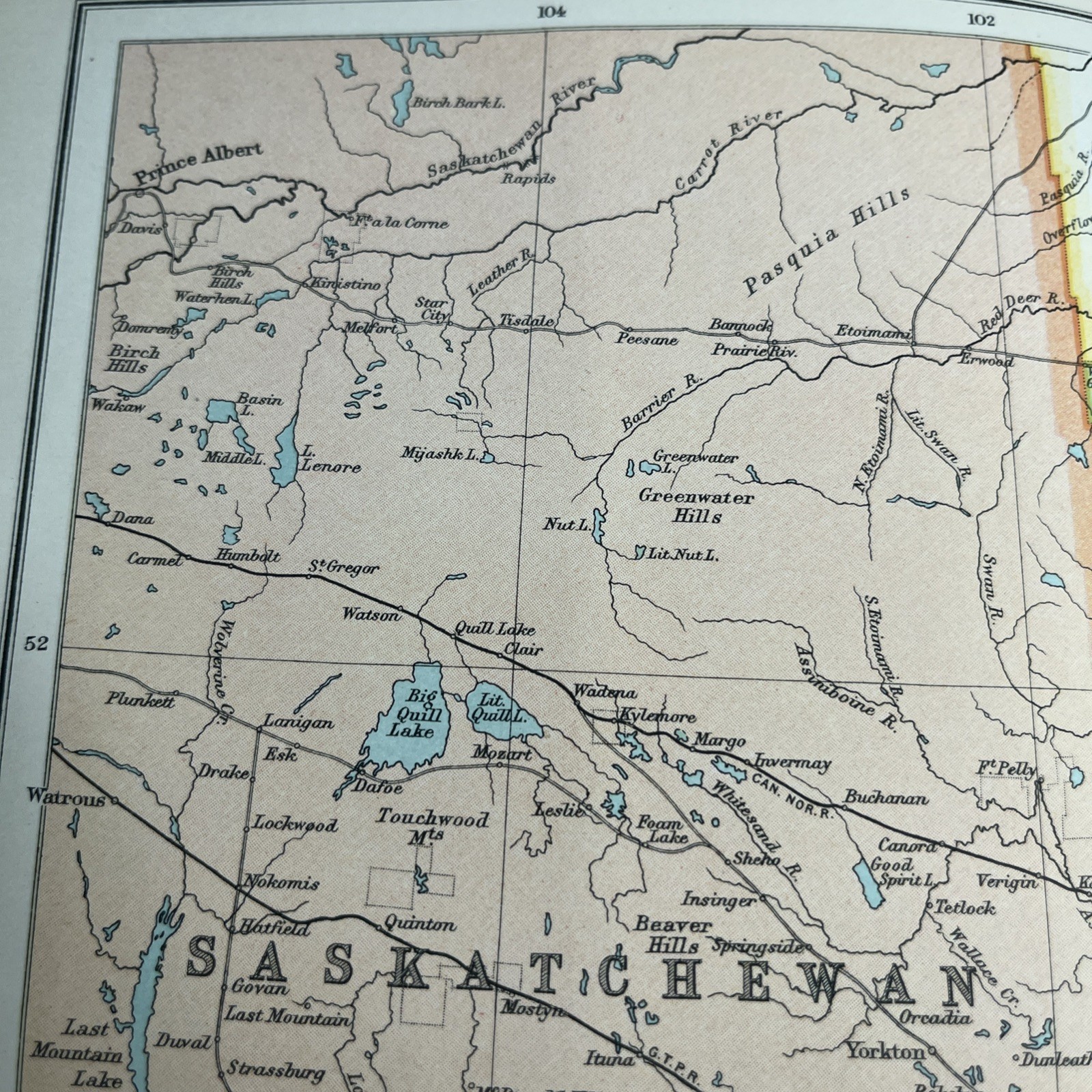
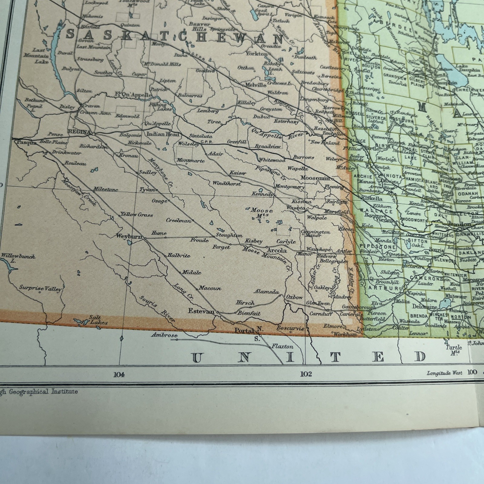
1910: Antique Map Of Manitoba Saskatchewan CS #65 Railway Atlas Antiquarian
GBP 19.95
ApproximatelyC $37.17
or Best Offer
Condition:
- Buy It Now1910: Antique Map Of Manitoba Saskatchewan CS #65 Railway Atlas Antiquarian
Oops! Looks like we're having trouble connecting to our server.
Refresh your browser window to try again.
Shipping:
GBP 21.69 (approx C $40.41) International Priority Shipping to United States via eBay's Global Shipping Program.
Located in: Leicester, United Kingdom
Import charges:
Free amount confirmed at checkout
Delivery:
Estimated between Thu, Nov 6 and Fri, Nov 14 to 94104
Includes international tracking
Returns:
No returns accepted.
Payments:
Shop with confidence
Seller assumes all responsibility for this listing.
eBay item number:277202473344
Item specifics
- Date Range
- 1910-1919
- Antique
- Yes
- Type
- Political Map
- Format
- Folding Map
- Printing Technique
- Lithography
- Year
- 1910
- Canadian Province
- Manitoba, Saskatchewan
- Era
- 1910s
- Original/Reproduction
- Antique Original
- Cartographer/Publisher
- John Bartholomew
Item description from the seller
Seller feedback (2,092)
- c***e (483)- Feedback left by buyer.Past 6 monthsVerified purchaseA lovely spoon in perfect condition. It is even better than as described and offers great value. The item was packaged carefully and posted promptly. Helpful communication from the seller combined to make this a perfect transaction - many thanks. Highly recommended A++++++++++++Collectors Spoon Benodet Spoon (#277213275318)
- r***c (758)- Feedback left by buyer.Past 6 monthsVerified purchasePetite cartographie du Continent Européen, de l’Atlantique à l’Oural, avant 1914, parfait état, très précise malgré son petit format. Envoi bien protégé et renforcé, soigneusement réalisé. L’objet parvient sécurisé : je remercie le vendeur pour son sérieux et sa fiabilité. Très content de cet achat. Merci.
- o***u (1047)- Feedback left by buyer.Past 6 monthsVerified purchaseBeautiful pictures & lovely frames. Very well packaged and arrived safely and exactly as expected. A1 seller2 x Fiona BUTLER Framed Prints Village Store Decor 11”x 13” Hand Signed gift (#277196872841)
More to explore:
- Manitoba Antique North America Atlas Maps,
- Saskatchewan Antique North America Atlas Maps,
- Manitoba Lithography Antique North America Atlas Maps,
- Manitoba Canada Antique North America Atlas Maps,
- Manitoba Antique Original Antique North America Atlas Maps,
- Antique Atlas Maps,
- 1910-1919 Date Range Antique World Atlas Maps,
- Atlas Map County Map 1910-1919 Date Range Antique Maps, Atlases & Globes,
- Atlas Map City Map 1910-1919 Date Range Antique Maps, Atlases & Globes,
- 1910-1919 Date Range Railroad Map Antique North America Atlas Maps