Picture 1 of 4


Picture 1 of 4


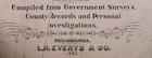
1887 Plat Map ~ LINCOLN CENTER, KANSAS / LINCOLN Co. COLD WATER on Reverse #283

Condition:
“Quick N Free S&H ~ Reasonable offers considered. Browse through over 4000 Rare, Authentic, Antique & ”... Read moreabout condition
Ended: May 11, 2024 18:35:00 EDT
Shipping:
Free USPS Ground Advantage®.
Located in: Schertz, Texas, United States
Delivery:
Estimated between Thu, Oct 3 and Tue, Oct 8 to 43230
Returns:
30 days return. Buyer pays for return shipping.
Payments:
Shop with confidence
Seller assumes all responsibility for this listing.
eBay item number:355693137804
Item specifics
- Seller Notes
- US State
- Kansas
- Format
- Plat Atlas Map
- Year
- 1887
- Color
- All colors are original.
- SIZE
- 17 x 27
- Cartographer/Publisher
- L. H. Everts & Co.
- Original/Reproduction
- Antique Original
- Original
- This map page was printed in 1887.
Item description from the seller

More to explore:
- Rand McNally & Co. Kansas Antique North America Maps & Atlases,
- Kansas City Map Antique North America Atlas Maps,
- Antique North American Maps & Atlases Kansas,
- Kansas River Map Antique North America Folding Maps,
- Kansas Antique North America City Maps,
- Rand McNally & Co. City Map Antique Folding Maps,
- Rand McNally & Co. Antique Atlas Maps,
- Rand McNally & Co. Antique Wall Maps,
- Rand McNally & Co. Antique Pull Down Maps,
- Rand McNally & Co. Antique World Maps & Atlases