Picture 1 of 5


Picture 1 of 5
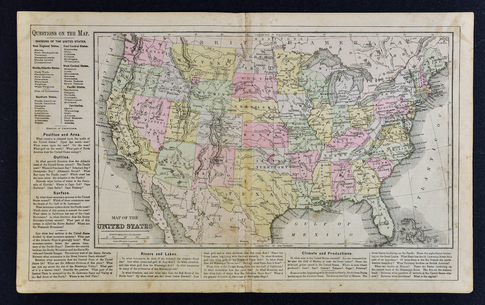
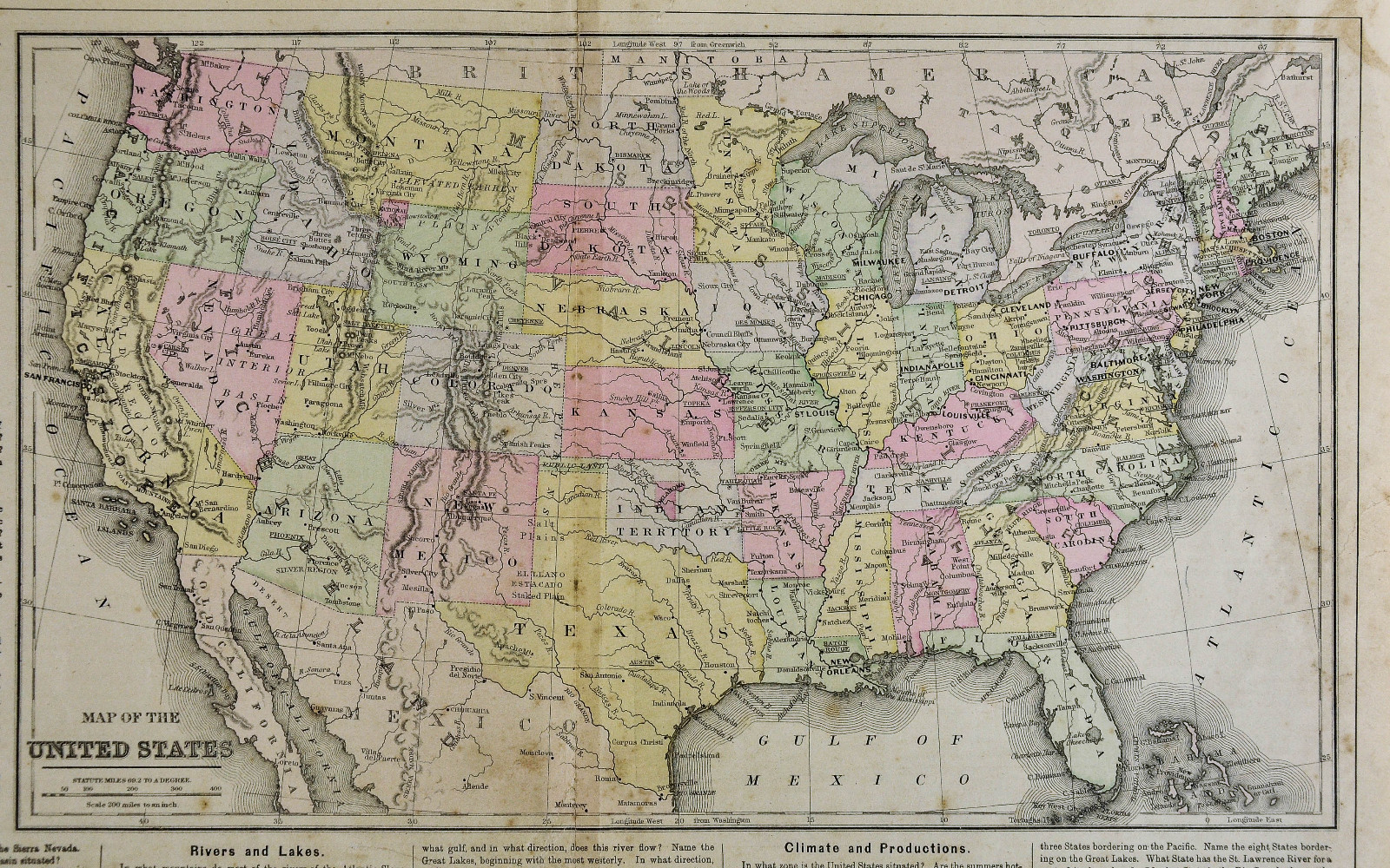

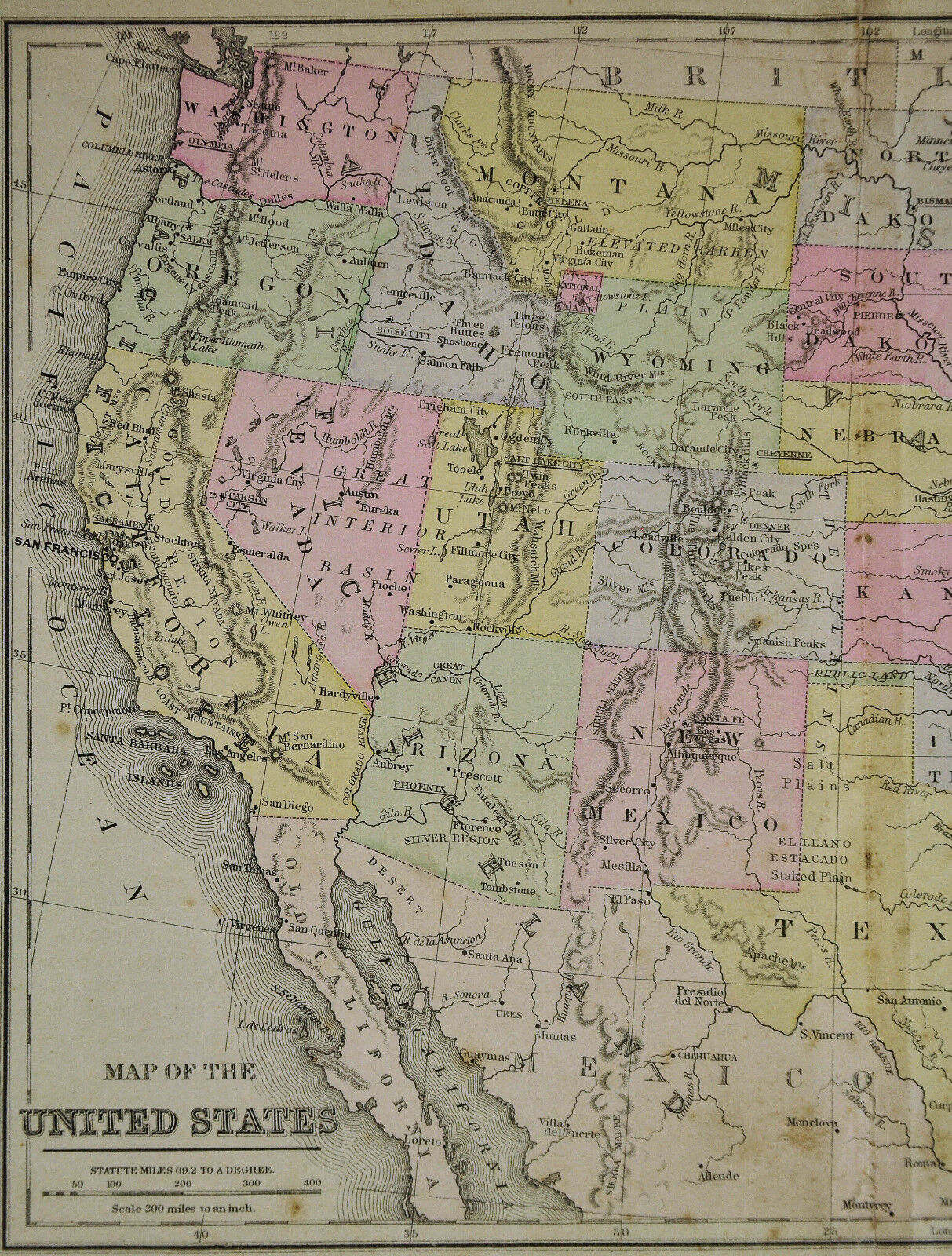

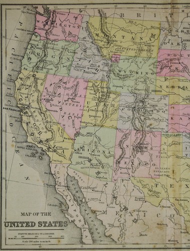
c 1889 Cowperthwait Map - United States - Indian Territory & Oklahoma Lands Rush

US $34.99
ApproximatelyC $47.22
or Best Offer
Condition:
“Fair, see the pics and description below, 9 by 15 inches on a 11 3/4 by 19" page”
Shipping:
US $4.99 (approx C $6.73) USPS Ground Advantage®.
Located in: Fairview, Pennsylvania, United States
Delivery:
Estimated between Fri, Sep 27 and Mon, Sep 30 to 43230
Returns:
30 days return. Seller pays for return shipping.
Payments:
Shop with confidence
Seller assumes all responsibility for this listing.
eBay item number:364674799140
Item specifics
- Seller Notes
- “Fair, see the pics and description below, 9 by 15 inches on a 11 3/4 by 19" page”
- Topic
- Maps
- Year
- 1889
- Publication Year
- 1889
- US State
- AL, FL, GA, MS, NC, SC, AR, IA, KS, LA, MO, NE, AZ, CA, CO, NM, NV, UT, CT, MA, ME, NH, RI, VT, DC, DE, MD, NJ, NY, PA, ID, OR, WA, IL, IN, MI, OH, WI, MN, MT, ND, SD, WY, OK, TX, Oklahoma, Texas, VA, WV, KY, TN
- Original/Reproduction
- Antique Original
- Date Range
- 1800-1899
- City
- Washington
- Type
- Political Map
- Format
- Atlas Map
- Country/Region
- United States of America
- Cartographer/Publisher
- Cowperthwait
Item description from the seller

Seller feedback (19,555)
- i***s (7)- Feedback left by buyer.Past 6 monthsVerified purchaseLove this map! Good description, fair price, good packaging, fast delivery. A++ transaction. Thank you.1885 McNally Map Virginia Richmond Lexington Washington Alexandria Charlotte VA (#364606710800)
- p***j (412)- Feedback left by buyer.Past 6 monthsVerified purchaseThe 1901 Tunison Map of Florida arrived quickly and exactly as described in excellent condition! Great seller communication! A very positive buying experience!!!
- w***r (1758)- Feedback left by buyer.Past yearVerified purchaseExcellent as always. A great item at great price from an outstanding dealer: extensive stock, friendly service, great communication. Prompt shipping, careful packaging. Very pleased to be a longtime customer. Bid with confidence A++++++++1835 Levasseur Map - Charlemagne Empire 8th Century Europe France Islamic Spain (#404661884287)
More to explore:
- United States of America Oklahoma Antique North America Topographical Maps,
- United States of America Oklahoma Antique North America Maps & Atlases,
- Northwest Territories United States of America Antique North American Maps & Atlases,
- Northwest Territories United States of America California Antique North America Maps & Atlases,
- United States of America Oklahoma Vintage Original Antique North American Maps & Atlases,
- United States of America Topographical Map Antique North America Atlas Maps,
- United States of America County Map Antique North America Atlas Maps,
- United States of America City Map Antique North America Folding Maps,
- United States of America Geological Map Antique North America Atlas Maps,
- Oklahoma Geological Map Antique North America Folding Maps