Picture 1 of 18


Gallery
Picture 1 of 18


Have one to sell?
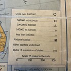
Our America United States Today 1949 Fold To Open Map On Canvas Wesley Social St
US $149.00
ApproximatelyC $206.45
or Best Offer
Condition:
- Buy It NowOur America United States Today 1949 Fold To Open Map On Canvas Wesley Social St
Oops! Looks like we're having trouble connecting to our server.
Refresh your browser window to try again.
Shipping:
Free USPS Ground Advantage®.
Located in: Fort Lauderdale, Florida, United States
Delivery:
Estimated between Wed, Aug 6 and Wed, Aug 13 to 94104
Returns:
No returns accepted.
Payments:
Shop with confidence
Seller assumes all responsibility for this listing.
eBay item number:376129128063
Item specifics
- Date Range
- 1940-1949
- Type
- Social Studies USA
- Printing Technique
- Lithography
- Format
- Folding Map
- Year
- 1949
- Canadian Province
- Quebec, Alberta, Saskatchewan
- City
- Chicago
- Country/Region
- United States of America
Item description from the seller
Seller feedback (42)
- 2***2 (297)- Feedback left by buyer.Past 6 monthsVerified purchaseGreat seller! The tiny glass bird was expertly packed and arrived as described. Thank you!
- l***p (473)- Feedback left by buyer.Past 6 monthsVerified purchaseNice dish as described, a good value for me. Shipped quickly & very well packaged
- i***4 (258)- Feedback left by buyer.Past yearVerified purchaseItem is exactly as it was described. Shipping was quick and priced fair, wouldn’t definitely buy from again. A+++++ seller, thanks for a great buying experience.Vintage Homer Laughlin Virginia Rose Sugar And Creamer Set June 1952 USA Gold Tr (#375043289875)
More to explore:
- United States of America Antique North America Folding Maps,
- United States of America Nautical Map Antique North America Folding Maps,
- United States of America Railroad Map Antique North America Folding Maps,
- United States of America City Map Antique North America Folding Maps,
- United States of America Political Map Antique North America Folding Maps,
- United States of America River Map Antique North America Folding Maps,
- United States of America Louisiana Antique North America Folding Maps,
- United States of America 1940-1949 Date Range Antique North America County Maps,
- United States of America County Map Antique North America Atlas Maps,
- United States of America Topographical Map Antique North America Wall Maps