
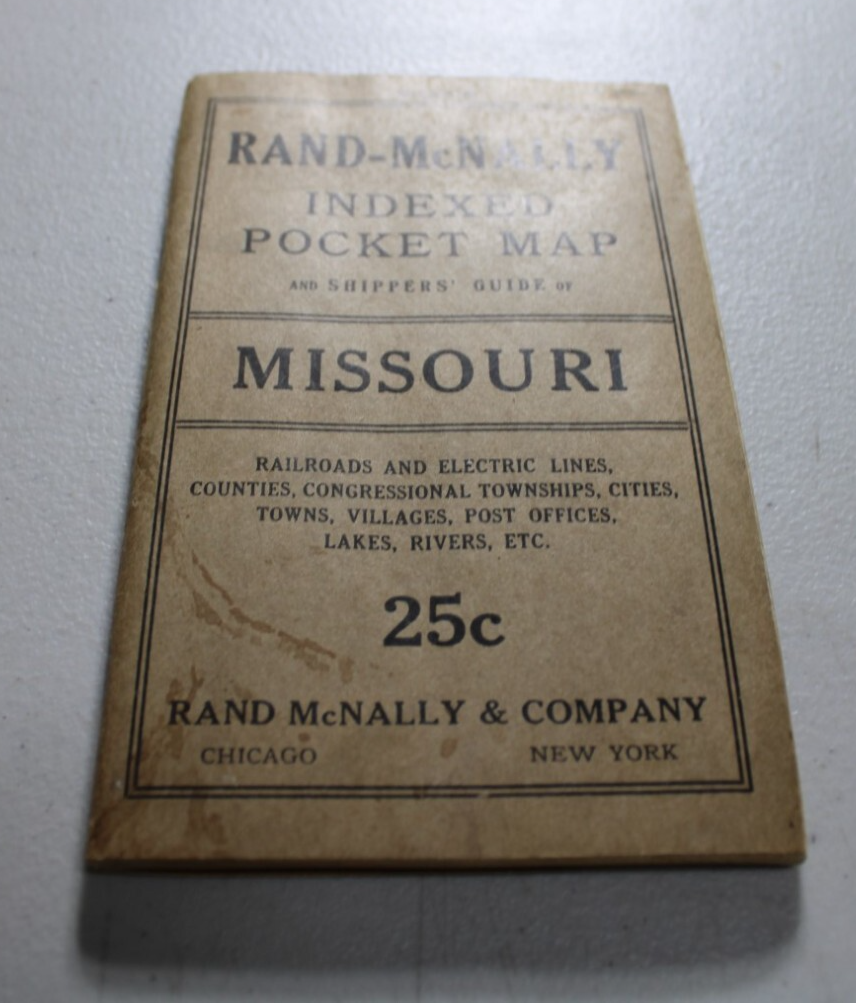
1915 Rand McNally Indexed Pocket Map of MISSOURI
US $34.99US $34.99
Fri, Jul 04, 09:57 AMFri, Jul 04, 09:57 AM
Picture 1 of 5


Gallery
Picture 1 of 5


Have one to sell?
1915 Rand McNally Indexed Pocket Map of MISSOURI
US $34.99
ApproximatelyC $48.76
or Best Offer
Condition:
“used ~ see description”
Oops! Looks like we're having trouble connecting to our server.
Refresh your browser window to try again.
Shipping:
US $10.75 (approx C $14.98) USPS Ground Advantage®.
Located in: Monroeville, Pennsylvania, United States
Delivery:
Estimated between Thu, Oct 2 and Tue, Oct 7 to 94104
Returns:
30 days return. Buyer pays for return shipping. If you use an eBay shipping label, it will be deducted from your refund amount.
Payments:
Shop with confidence
Seller assumes all responsibility for this listing.
eBay item number:376159548054
Item specifics
- Seller Notes
- “used ~ see description”
- Date Range
- 1910-1919
- Format
- Folding Map
- US State
- AR, IA, KS, LA, MO, NE, Missouri
- Year
- 1915
- Original/Reproduction
- Antique Original
- Cartographer/Publisher
- Rand McNally & Co.
- Country/Region
- United States of America
Item description from the seller
Popular categories from this store
Seller feedback (25,590)
- n***s (8393)- Feedback left by buyer.Past 6 monthsVerified purchaseI have bought many things from this seller and this will serve to be the feedback for all. I am very pleased. All are as described, or better. The packaging is secure and professional. Shipping is fast and I feel that everything that I purchased has been priced fairly. When communication was needed, it was prompt and courteous. You may buy from this store with complete confidence.
- e***k (2453)- Feedback left by buyer.Past monthVerified purchaseItem photographed for the listing was the one received. The real article is beautiful, in better shape and of finer visual quality than could be conveyed in a picture. Skillful packing by the seller assured that it arrived in pristine condition. The mailer was rigid and protected the print. Great deal on this gorgeous leaf.
- 0***2 (241)- Feedback left by buyer.Past 6 monthsVerified purchaseThrough no fault of seller this item went AWOL in USPS. However, from the very beginning, customer service was A+, communication was as well and although a refund had to be issued, this seller went out of his way to ensure a successful transaction--USPS just got in the way. Would recommend this seller.1883 Map / OUTLINE MAP OF TOWNSHIPS IN MEIGS COUNTY, OHIO / 10.5x14.5 inches (#335116478030)
More to explore:
- Missouri Rand McNally & Co. Antique North America Maps & Atlases,
- Missouri Rand McNally & Co. Antique North America Atlas Maps,
- Rand McNally & Co. Antique Physical Maps,
- Rand McNally & Co. Antique Atlas Maps,
- Rand McNally & Co. Antique City Maps,
- Rand McNally & Co. City Map Antique Folding Maps,
- Rand McNally & Co. Antique Asia Atlas Maps,
- Rand McNally & Co. Lithography Antique Topographical Maps,
- Rand McNally & Co. Antique World Wall Maps,
- Rand McNally & Co. Lithography Antique Atlas Maps