
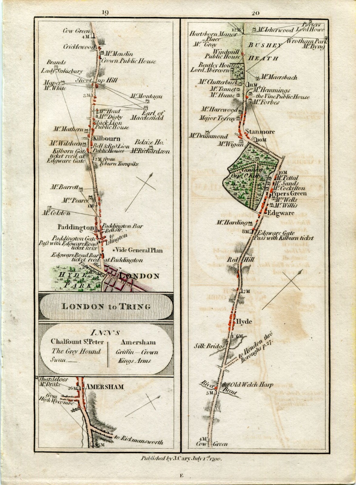
1790 Cary Map 19/20 Amersham, London, Paddington, Kilburn, Cricklewood, The Hyde
AU $75.00AU $75.00
Tue, Jul 22, 01:11 AMTue, Jul 22, 01:11 AM
Picture 1 of 1

Gallery
Picture 1 of 1
Have one to sell?
1790 Cary Map 19/20 Amersham, London, Paddington, Kilburn, Cricklewood, The Hyde
AU $75.00
ApproximatelyC $67.23
or Best Offer
Was AU $100.00 (25% off)
Condition:
“Good for its age. As with all old maps/prints there may be minor imperfections, age toning etc... I ”... Read moreabout condition
Ended: Jul 22, 2025 01:11:38 EDT
Oops! Looks like we're having trouble connecting to our server.
Refresh your browser window to try again.
Shipping:
AU $20.00 (approx C $17.93) International Standard : tracked-signature (7 to 15 business days).
International shipment of items may be subject to customs processing and additional charges.
Located in: Surfers Paradise, QLD, Australia
Delivery:
Estimated between Tue, Aug 5 and Fri, Aug 15 to 94104
Returns:
No returns accepted.
Payments:
Shop with confidence
Seller assumes all responsibility for this listing.
eBay item number:385612759833
Item specifics
- Seller Notes
- Date Range
- 1700-1799
- Type
- Road Atlas
- Format
- Atlas Map
- Printing Technique
- Copper Plate
- Year
- 1790
- Original/Reproduction
- Antique Original
- Cartographer/Publisher
- John Cary
- Region of Origin
- Europe
- Country/Region
- England
Item description from the seller
Seller Feedback
No feedback yet
This is a private listing and your identity will not be disclosed to anyone except the seller.
More to explore:
- John Cary Antique Atlas Maps,
- Antique European Maps & Atlases John Cary,
- John Cary Antique Maps, Atlases & Globes,
- John Cary Antique Europe Atlas Maps,
- London London Antique Europe Sheet Maps,
- London London Antique Europe County Maps,
- London London Antique Europe Atlas Maps,
- Antique European Maps & Atlases London London,
- London London Lithography Antique Europe Maps & Atlases,
- London Antique Europe County Maps