
Picture 1 of 3


ENDED
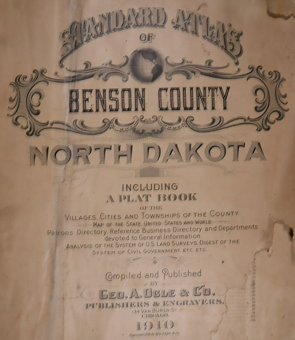
1910 Plat Map ~ WEST BAY Twp. - MINNEWAUKAN, BENSON Co., NORTH DAKOTA ~ Free S&H
Condition:
“Quick N Free S&H ~ Reasonable offers considered. Browse through 1,000s of Rare, Authentic, Antique & ”... Read moreabout condition
Ended: May 10, 2024 14:03:42 EDT
Price:
US $45.95
ApproximatelyC $62.67
Was US $48.88
Save US $2.93 (6% off)
Shipping:
Located in: Schertz, Texas, United States
Delivery:
Estimated between Thu, May 30 and Tue, Jun 4 to 43230
Returns:
Payments:
Shop with confidence
Seller assumes all responsibility for this listing.
eBay item number:404916133258
Item specifics
- Seller Notes
- Frame
- Suitable for framing.
- US State
- North Dakota
- Color
- All colors are original.
- Cartographer/Publisher
- Geo. A. Ogle
- Date Range
- 1910
- Type
- Plat & County Map
- Format
- Plat Atlas Map
- Year
- 1910
- Ref#
- BENSON-ND1910/022523
- Original/Reproduction
- Antique Original
- Country/Region
- United States of America
- Original
- This map page was printed in 1910.
Item description from the seller
Seller assumes all responsibility for this listing.
eBay item number:404916133258
Shipping and handling
Item location:
Schertz, Texas, United States
Ships to:
Worldwide
Excludes:
Barbados, French Guiana, French Polynesia, Guadeloupe, Libya, Martinique, New Caledonia, Reunion, Russian Federation, Ukraine, Venezuela
| Shipping and handling | To | Service | Delivery*See Delivery notes |
|---|---|---|---|
| Free shipping | United States | Standard Shipping (USPS Ground Advantage®) | Estimated between Thu, May 30 and Tue, Jun 4 to 43230 |
| Handling time |
|---|
| Will usually ship within 5 business days of receiving cleared payment. |
| Taxes |
|---|
| Taxes may be applicable at checkout. Learn moreLearn more about paying tax on eBay purchases |
Sales tax for an item #404916133258
Sales tax for an item #404916133258
Seller collects sales tax for items shipped to the following provinces:
| Province | Sales Tax Rate |
|---|
Return policy
| After receiving the item, contact seller within | Refund will be given as |
|---|---|
| 30 days after the buyer receives it | Money Back |
The buyer is responsible for return shipping costs.
Payment details
Payment methods

More to explore:
- North Dakota Antique North American Maps & Atlases 1910-1919 Date Range,
- North Dakota 1910-1919 Date Range Antique North America County Maps,
- West Virginia Antique North American Maps & Atlases 1910-1919 Date Range,
- West Virginia Rand McNally & Co. Antique North America Maps & Atlases,
- North Dakota Antique Original Antique North American Maps & Atlases 1910-1919 Date Range,
- North Dakota Antique North America County Maps,
- North Dakota Antique North America Atlas Maps,
- North Dakota Antique North America Sheet Maps,
- West Virginia Topographical Map Antique North America Folding Maps,
- West Virginia Antique North America Maps & Atlases