
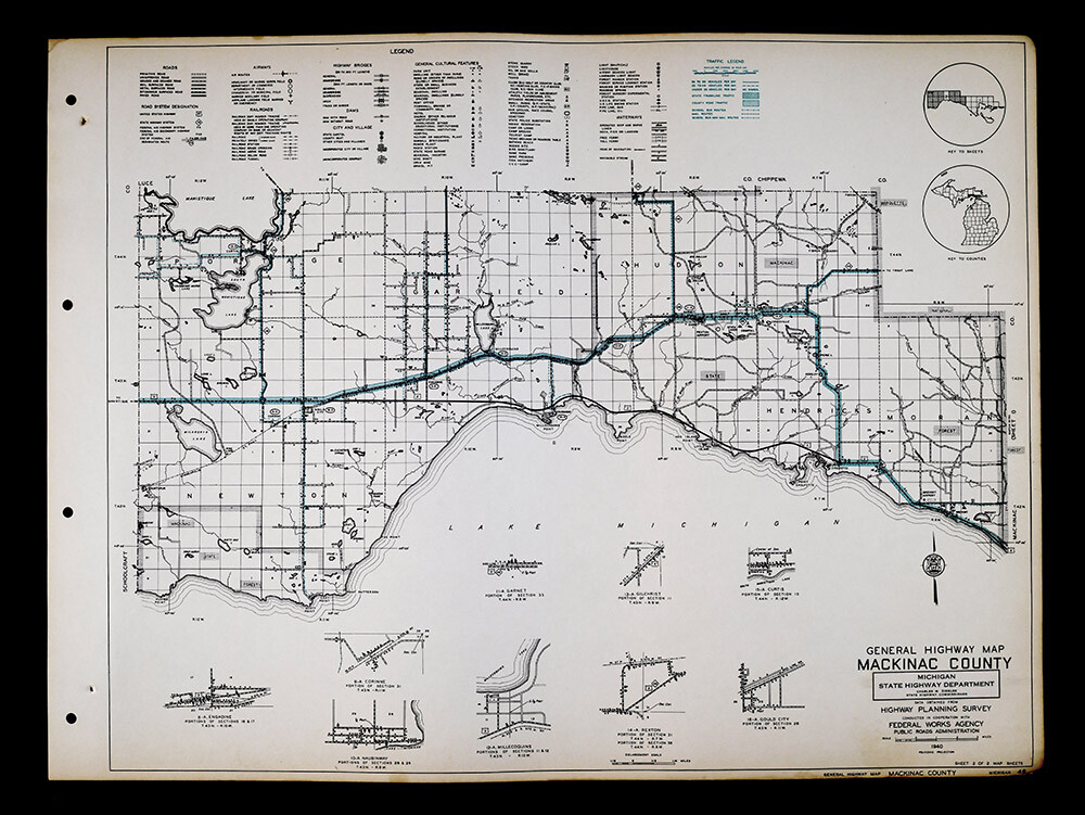
1940 Michigan Highway Map West Mackinac County Naubinway Epoufette Brevort Gould
US $65.00US $65.00
Fri, Jul 04, 06:33 PMFri, Jul 04, 06:33 PM
Picture 1 of 5


Gallery
Picture 1 of 5


Have one to sell?
1940 Michigan Highway Map West Mackinac County Naubinway Epoufette Brevort Gould
US $65.00
ApproximatelyC $89.56
or Best Offer
Condition:
“Very Good Condition, approximately 17 1/2 by 22 1/4 inches (44x57cm) on an 18 1/4 by 24" page ”... Read moreabout condition
Oops! Looks like we're having trouble connecting to our server.
Refresh your browser window to try again.
Shipping:
US $4.99 (approx C $6.88) USPS Ground Advantage®.
Located in: Fairview, Pennsylvania, United States
Delivery:
Estimated between Sat, Aug 9 and Fri, Aug 15 to 94104
Returns:
30 days return. Seller pays for return shipping.
Payments:
Shop with confidence
Seller assumes all responsibility for this listing.
eBay item number:405267931407
Item specifics
- Seller Notes
- Cartographer/Publisher
- Charles Ziegler
- Original/Reproduction
- Antique Original
- Format
- Highway Map
- Type
- County Map
- Year
- 1940
- US State
- IL, IN, MI, OH, WI, Michigan
- Date Range
- 1940-1949
- City
- Detroit
- Country/Region
- United States of America
Item description from the seller
Seller Feedback
No feedback yet
More to explore:
- Michigan Antique North America County Maps,
- Michigan County Map Antique North America Atlas Maps,
- Michigan Lithography Antique North America County Maps,
- West Virginia Antique North America County Maps,
- Michigan Antique Original Antique North America County Maps,
- 1940-1949 Date Range Sheet Map County Map Antique Maps, Atlases & Globes,
- Antique County Maps,
- West Virginia Antique Original Antique North America County Maps,
- Michigan 1920-1929 Date Range Antique North America County Maps,
- 1940-1949 Date Range Antique North America County Maps