Picture 1 of 4


Gallery
Picture 1 of 4
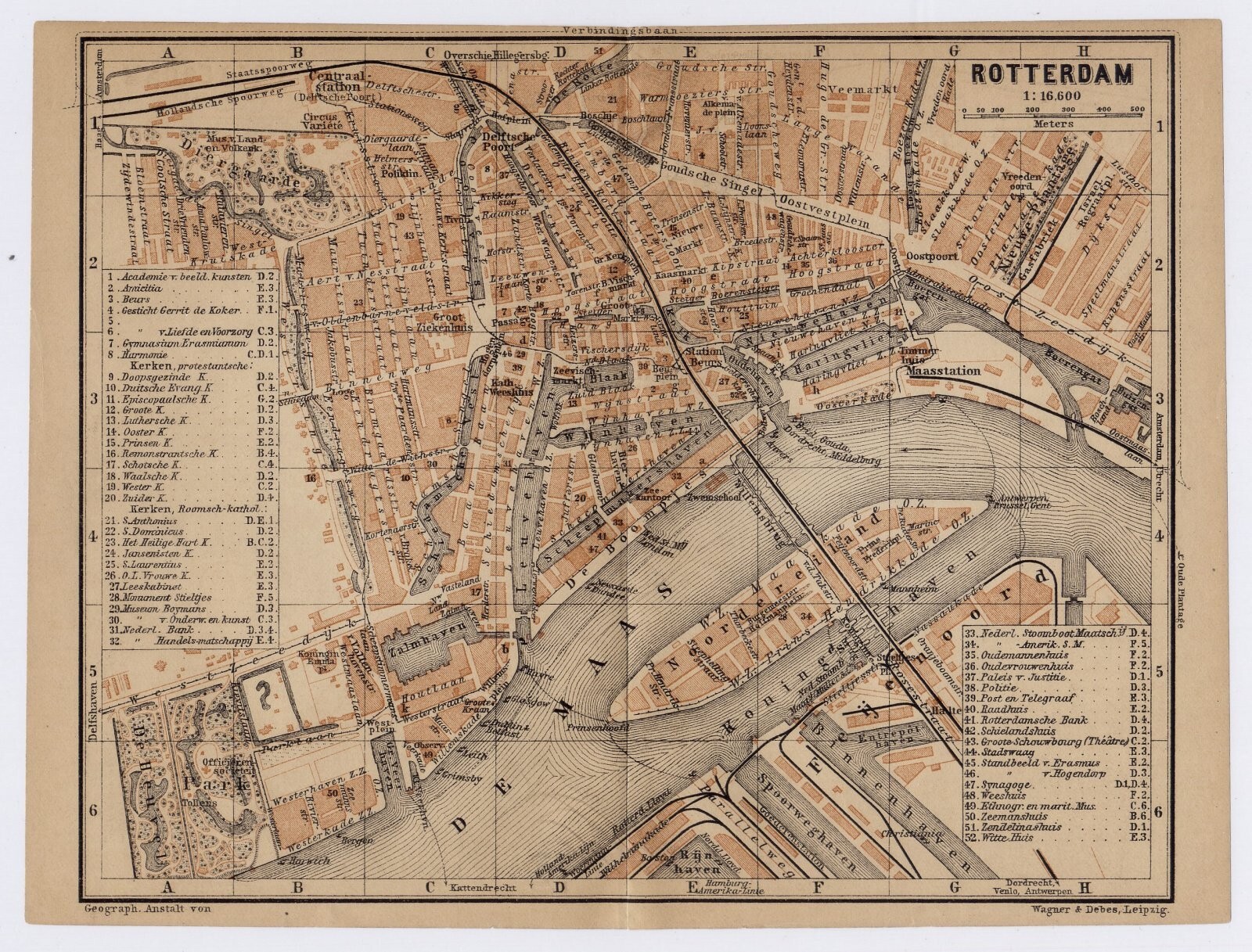


1900 ANTIQUE CITY MAP OF ROTTERDAM / HOLLAND / NETHERLANDS
US $25.58
ApproximatelyC $35.33
or Best Offer
Condition:
“GOOD / SIZE: 8" x 6" (20 x 15 cm). BROWNED.”
Oops! Looks like we're having trouble connecting to our server.
Refresh your browser window to try again.
Shipping:
Free Standard Shipping from Canada.
International shipment of items may be subject to customs processing and additional charges.
Located in: Montreal, Quebec, Canada
Delivery:
Estimated between Fri, May 9 and Thu, May 15 to 43230
Please allow additional time if international delivery is subject to customs processing.
Returns:
60 days return. Seller pays for return shipping.
Payments:
Shop with confidence
Seller assumes all responsibility for this listing.
eBay item number:405514487557
Item specifics
- Seller Notes
- “GOOD / SIZE: 8" x 6" (20 x 15 cm). BROWNED.”
- Date Range
- 1900-1909
- Type
- City Map
- Year
- 1900
- City
- Rotterdam
- Country/Region
- Holland
Item description from the seller
Seller Feedback
No feedback yet
More to explore:
- Antique European Maps & Atlases Rotterdam Holland,
- Netherlands Antique Europe City Maps,
- Netherlands City Map Antique Europe Sheet Maps,
- Netherlands Antique Original Antique Europe City Maps,
- Netherlands Lithography Antique Europe City Maps,
- Holland Amsterdam Antique Europe City Maps,
- Netherlands Antique Europe Atlas Maps,
- Netherlands Antique Original Antique European Maps & Atlases,
- Holland 1600-1699 Date Range Antique Europe City Maps,
- Antique Europe City Maps