Picture 1 of 8


Gallery
Picture 1 of 8
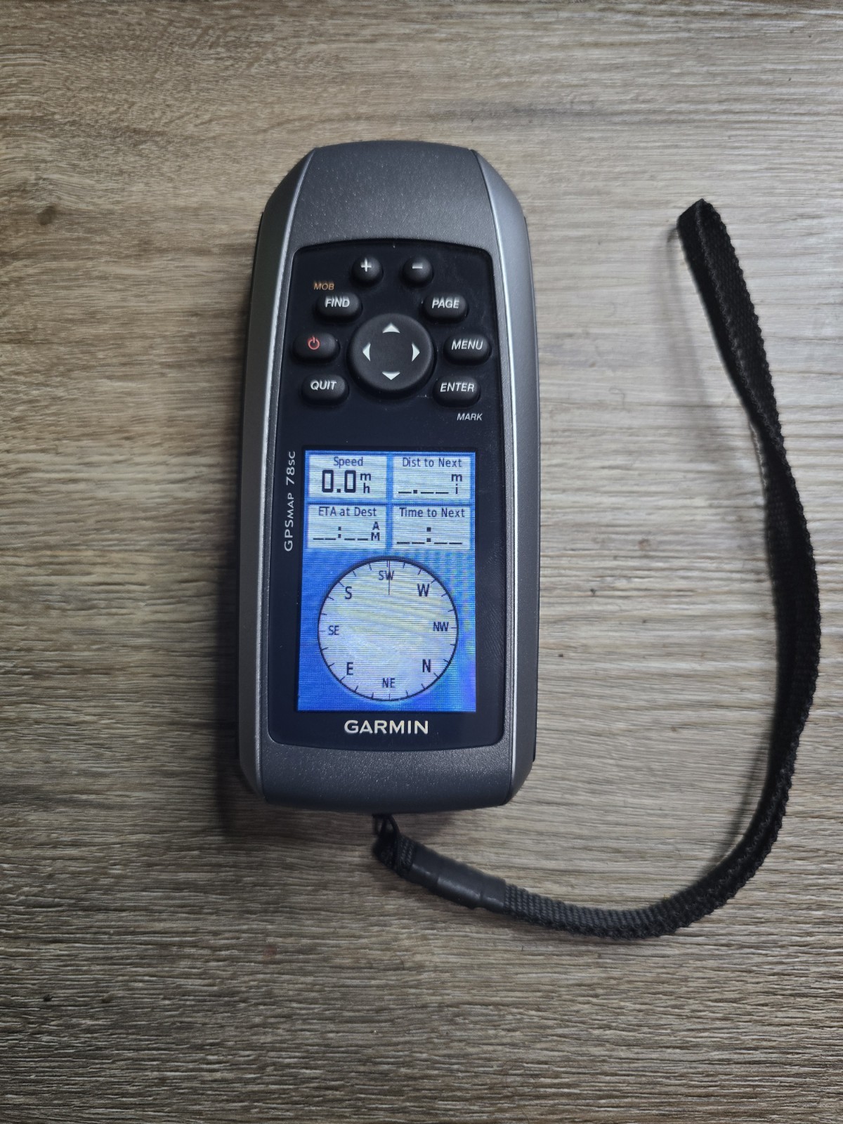


Garmin GPSMAP 78sc Handheld GPS With Usb Cable
US $189.00
ApproximatelyC $261.39
Was US $210.00 (10% off)
Condition:
Used
An item that has been used previously. The item may have some signs of cosmetic wear, but is fully operational and functions as intended. This item may be a floor model or store return that has been used. See the seller’s listing for full details and description of any imperfections.
Ended: Apr 28, 2025 15:23:53 EDT
Oops! Looks like we're having trouble connecting to our server.
Refresh your browser window to try again.
Shipping:
Located in: Portland, Oregon, United States
Delivery:
Varies
Returns:
No returns accepted.
Payments:
Shop with confidence
Seller assumes all responsibility for this listing.
eBay item number:405812143771
Item specifics
- Condition
- UPC
- 0753759100926
About this product
Product Information
For those who navigate along coasts, the rugged Garmin GPSMAP 78sc marine-friendly GPS is a perfect device, thanks to its BlueChart g2 coastal charts and a worldwide basemap. The built-in barometric altimeter of this Garmin navigator tracks changes in pressure to locate your precise altitude. This marine-friendly GPS also lets you wirelessly share your waypoints, tracks, routes, and geocaches with other compatible devices. Using the embedded track log of this Garmin navigator, you can save up to 10000 points or 200 tracks. With a hunt/fish calendar, the Garmin GPSMAP 78sc GPS receiver lets you know the perfect time for fishing and hunting.
Product Identifiers
Brand
Garmin
MPN
010-00864-02
UPC
0753759100926
Model
GPSMAP 78sc
eBay Product ID (ePID)
84953735
Product Key Features
Unit Size
Not Applicable
Features
Waterproof
Screen Size
2.6"
Type
Marine
Dimensions
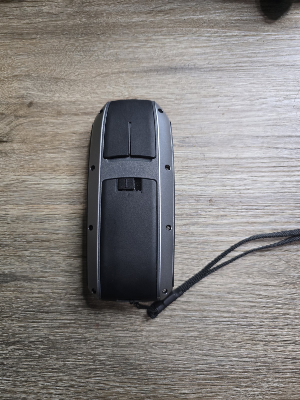
Weight
7.7 Oz
Depth
1.2in
Height
2in
Width
6in
Additional Product Features
Battery Type and Quantity
2X AA Batteries
Environmental Protection
High Impact Plastic Alloy Body
Battery Life
20h
Display Type
Transflective, 65-K Color Tft
Trip Calculator
Track Log
User Interface
Keypad
Installed Memory
1.70GB
Antenna Type
Built-In
Map Capabilities
Map Cartridges / Data Cards
Expansion Slot Type
microSD Slot
Resolutions
160x240 Pixels
Display Size
2.6in
PC Interface
USB 2.0
Usage
Marine
Update Rate
1 Per Second, Continuous
System Type
Handheld
Waas Features
Waas Enabled
Item description from the seller
Seller feedback (34)
- o***d (1)- Feedback left by buyer.Past 6 monthsVerified purchaseThe Speaker is in excellent condition and works wonderfully. The Seller was very helpful and the package arrived in good condition and quickly. Not a single complaint; very happy with my purchase. Would definitely buy again from this seller.Reply from: flash758- Feedback replied to by seller flash758.- Feedback replied to by seller flash758.Thank you so much! I'm glad you're happy with your purchase.
- f***1 (37)- Feedback left by buyer.Past 6 monthsVerified purchaseFAST SHIPPING GOOD PACKING AS DESCRIBED VARY GOOD VALUE.Reply from: flash758- Feedback replied to by seller flash758.- Feedback replied to by seller flash758.Thank you so much! I'm glad you're happy with your purchase.
- d***1 (1126)- Feedback left by buyer.Past monthVerified purchaseExcellent seller and fast shipping. Great price and communication. Recommended.Reply from: flash758- Feedback replied to by seller flash758.- Feedback replied to by seller flash758.Thank you so much! I'm glad you're happy with your purchase.
Product ratings and reviews
Most relevant reviews
- Jun 30, 2016Top favourable review
Not Garmin's Best
Verified purchase: YesCondition: NewSold by: pricebreak-deals
- Aug 02, 2021Top critical review
Garmin to small to use
Verified purchase: YesCondition: Pre-OwnedSold by: dryflies97
- Mar 25, 2021
Nice tool for your basic needs.
Verified purchase: YesCondition: NewSold by: purpletechnado
- Jan 16, 2019
Could be a much better cost comparison.
Verified purchase: YesCondition: Pre-OwnedSold by: electronicswarehouse44
- Oct 28, 2020
Good lower end unit.
Verified purchase: YesCondition: Pre-OwnedSold by: waldrop7070
More to explore:
- Garmin Car GPS Units Garmin GPSMAP 78sc,
- Garmin GPSMAP Handheld/Outdoor Car GPS Units,
- Garmin GPSMAP 60CSx Handheld/Outdoor Car GPS Units,
- Garmin GPSMAP 62s Handheld/Outdoor Car GPS Units,
- Garmin GPSMAP Car GPS Units,
- Garmin Car GPS Units Garmin GPSMAP,
- Garmin GPSMAP 60CSx Car GPS Units,
- Garmin GPSMAP 62s Car GPS Units,
- Garmin GPSMAP 12 Inch Car GPS Units,
- Garmin GPSMAP 10 Inch Car GPS Units